Mihai Tanase
helping with science
About
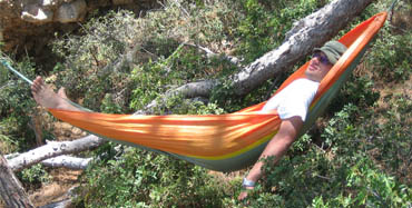
Born and raised in Bucharest I started my trip around the world at 14 when I moved north to study forestry within a specialized high school program followed by a BS in Forest Management. Once task accomplished, nine years later, I returned home working as an engineer at the Forest Research and Management Institute. During this period I have also enhanced my education with a bachelor in economics. Five years later I have decided to follow a Masters program at the Mediterranean Agronomic Institute of Chania (Greece). This brought a change to my career which afterwards focused on remote sensing applications for forest management. Following the master, I went for a PhD degree at the University of Saragossa (Spain). A postdoctoral fellowship at the University of Melbourne set me adrift towards the end of the world were I have remained since together with my dear companions Cris, Oscar and Marcos. As a good forester I like trekking, camping, and generally all kind of outdoors activities. I also like learning new things and taking on new challenges. You will learn more about me by browsing this website. If you want to know about my professional background, check the “Research” page. The photo gallery showcases some of my trips, activities and friends. For any doubt, curiosity or suggestion contact me.
Mihai Tanase
helping with science
Resume
-
Research Interests
-
Natural Hazards
(forest fires, floods)
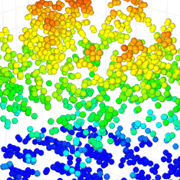
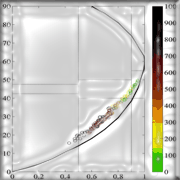
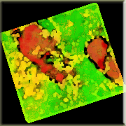
My interests are focused on pre- and post-fire forest management and the use of remote sensing for landscape scale assessment of fuel type, fuel load, fire effects and live fuels moisture content. I am using a variety of remote sensing sensors from high resolution optical to synthetic aperture radar and airborne laser scanning. Over the past 10 years I have developed new methods based on SAR for estimating fire severity and forest regrowth in a range of environments. The pioneering nature of this effort resulted in the publication of several articles one of which was awarded the Interactive Prize Paper Award by the IEEE Geoscience and Remote Sensing Society. I have also demonstrated the utility of SAR data for the retrieval of live canopy moisture content which is relevant for fire risk evaluation. Recently, I have proposed the use of a novel index, the standardized Radar Burn Ratio, for the estimation of fire severity without the need for a priori information from field campaigns.
-
Carbon cycling
(forest biomass, fire emissions)
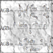
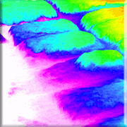
I am interested in airborne and space-borne radar data to understand the main factors influencing forest biomass quantification errors. My work focuses on improving biomass estimation accuracy from dense multi-temporal series and advanced radar techniques such as polarimetry and interferometry. I have also worked on enhancing existing backscatter models with a priori forest structural information obtained from lidar sensors.
-
Environmental change
(land use & land cover change)
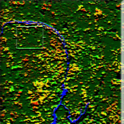
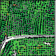
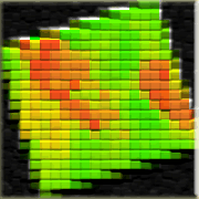
I am also interested in broad scale changes of land use land cover types with an emphasis on forest change caused by natural disasters or the anthropic influence. I am using a range of methods and sensors such as object and pixel based classification techniques, change detection, and trajectory analysis as well as a range of sensors from high and very high spatial resolution optical satellite images to synthetic aperture radar and their synergy.
-
-
Education
-
PhD Geography
University of Zaragoza (2006-2010)
Spatial Planning and Environment program Thesis: SAR Sensitivity to Burn Severity and Forest Recovery in Mediterranean Environments – backscatter and interferometric coherence analysis. Grade: Maxima cum laude with European Honors, Date: December 3rd 2010.
-
MSc Environmental Management
Mediterranean Agronomic Institue of Chania (2004-2006)
Curricula on Remote Sensing and GIS for environmental management Thesis: Fuel type mapping using high and very high spatial resolution satellite imagery”. Grade: Maxima cum laude
-
BSc Economics
Academy of Economic Studies (1999-2003)
Financial markets and banking program, Thesis: Mortgage loans, a way to develop real estate market in Romania.
-
BSc Honors Silviculture
Stefan cel Mare University (1994-1999)
Silviculture and forest management, Thesis: Decadal forest management planning for Doroteia forest district.
-
-
Employment
-
University of Alcala
Research Fellow (2015-present)
Multi-temporal data series analysis and radar-optical data fusion for vegetation and natural disasters monitoring
-
University of Melbourne
Research Fellow (2011-2014)
Development of algorithms for forest characterization from remote sensing data with an emphasis on radar and lidar sensors; Analysis of spatial patterns of vegetation moisture content; Calibration and validation of airborne synthetic aperture radar data; Development of field protocols for data collection; Field data collection and processing; Planning airborne surveys; Soil moisture estimation.
-
University of Zaragoza
Research Fellow (2008-2010)
Polarimetric, interferometric and backscatter analysis of synthetic aperture radar data over areas affected by natural hazards; Forest monitoring using synthetic aperture radar data; Burn severity estimation at regional level using optical sensors.
-
Mediterranean Agronomic Institute of Chania (part-time)
Research assistant (2005-2006)
Development of land-cover/land-use maps using QuickBird and Ikonos satellite imagery and object-oriented analysis; Research on hyper-spectral satellite imagery for pre-fire planning and management; Pixel and object oriented mapping of forest fuels; Collection of vegetation spectral signatures; Accuracy assessment of the derived mapping products.
-
Forest Research and Management Institute
Research fellow (2002-2004)
Forest monitoring within the framework of the European ICP program and the Romanian national monitoring program; Monitoring air pollution effects on forest health in the Carpathian Mountains; Forest management planning and conservation of virgin forests; Field data collection, processing and analysis.
-
Forest Research and Management Institute
Engineer (1999-2002)
Forest management planning; Statistical analysis on wood volume harvested at national level from private forests; Statistical analysis on forest excluded from the privatization process.
-
-
Remote Sensing Skills
Optical sensors 70% SAR sensors 85% LiDAR 70% Signal processing 35% Field campaign 85% -
Software skills
Gamma RS 85% ITT ENVI 80% ESRI ArcGIS 70% Matlab 50% Statistica & SPSS 50% PolSARpro 70% Erdas Imagine 65% IDRISI 40%
Mihai Tanase
helping with science
Research
- All
- ground sensors
- field data
- lidar
- sar
- optical
- insar
- x-band
- c-band
- l-band
- polsar
- data fusion
-
 Forest Health Monitoring
 -
 Air Pollution
 -
 Leaf Area Index
 -
 Forest Biomass
 -
 Fire Severity
 -
 Soil Moisture
 -
 Field campaign
 -
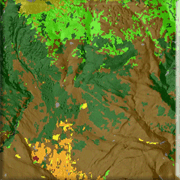 Fuel Mapping
 -
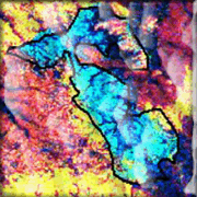 Fire Severity
 -
 Fire Severity
 -
 Fire Severity
 -
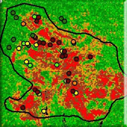 Fire severity
 -
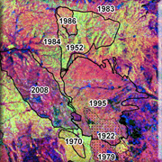 Forest Regrowth
 -
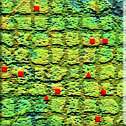 Forest Biomass
 -
 Forest Biomass
 -
 Fire Severity
 -
 Biomass Modelling
 -
 Surface Roughness
 -
 Change Detection
 -
 Land Use Mapping
 -
 Radar Burn Ratio
 -
 SAR & Optical
 -
 Forest Height
 -
 Fuel Moisture
Mihai Tanase
helping with science
Contact
Contact Info
m: Madrid 28250, Spain
p: +34 671 12 01 22
Drop me a line