Fuels, Fire, Flourish: remote sensing synergies to unravel fuel dynamics, fire impact and forest recovery
Objectives
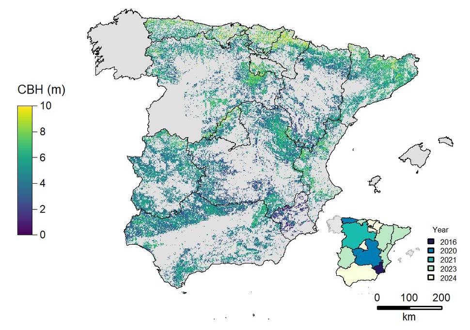
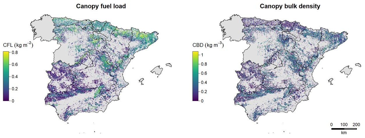
Characterise and monitor fuel structural properties
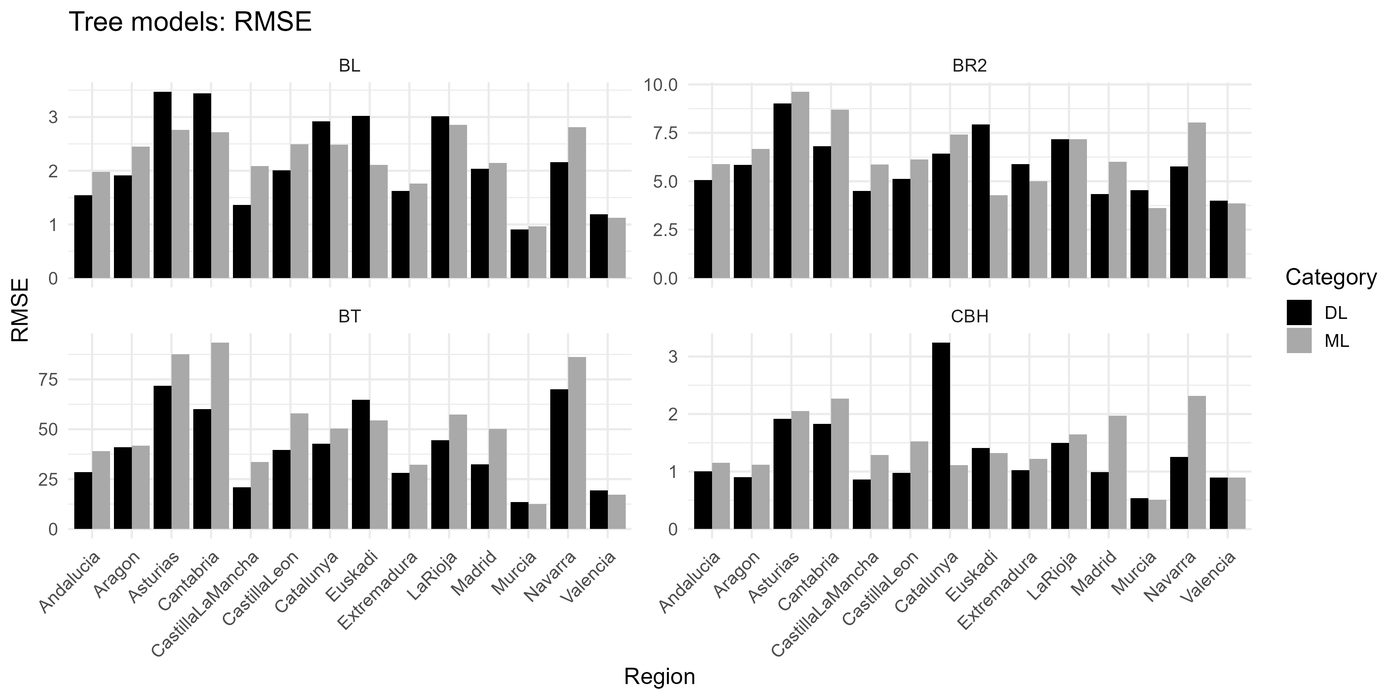
Canopy fuels — fuel load, canopy height, canopy base height, canopy cover, canopy bulk density — and understory fuels — density and height. Reference information comes from high-density airborne lidar, propagated through time and space with satellite time series, pixel-level disturbance history (1985–2024) and ancillary climate and terrain variables. Terrestrial laser scanning provides the bottom-up view needed to separate understory from canopy.
Fire impact assessment and emission estimates
Redevelop the Radar Burn Ratio within a multi-sensor, multi-wavelength framework so that it carries information from both the top of the canopy (C-band) and below it (L-band), adding interferometric coherence and L-band scattering-centre height. Biome-specific indices are pre-calibrated against in-situ observations, then combined with fuel load to estimate greenhouse gas emissions through a book-keeping approach.
Post-fire recovery from active-passive sensor synergies
Track recovery in all major fire disturbance events in the Spanish Atlas of Forest Disturbances. A repurposed CCDC-SMA analysis detects positive change in the optical signal, then lidar and L-band radar take over where optical reflectance saturates, giving structural recovery rather than cover recovery alone.
Approach
Large (2–3 M ha) areas forming a north–south transect across the Atlantic and Mediterranean biomes, with contrasting vegetation types and fire regimes.
The third national PNOA lidar campaign at 5 points m⁻² provides the reference canopy fuels; SLAM terrestrial scanning adds the understory; National Forest Inventory plots calibrate the biomass fractions.
Multi-wavelength backscatter, coherence and scattering-centre height for a pre-calibrated Radar Burn Ratio; in-situ fire impact data collected in large (>500 ha) fires.
A 35+ year optical trajectory for regeneration, extended with structural recovery from lidar and radar once the optical signal saturates.
Results